Section 2
Spatial Strategy: The 200-Acre Master Layout
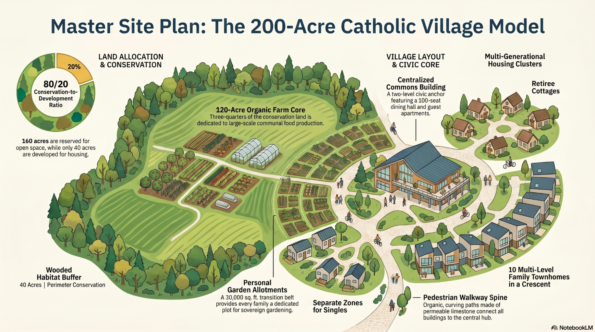
Master Site Plan: The 200-Acre Catholic Village Model
The structural integrity of this plan relies on the "80/20 Rule": 160 acres of conservation and production shielding a 40-acre developed footprint. This ratio is a critical engineering safeguard, ensuring that the community possesses the necessary land mass for economic self-sufficiency while maintaining a manageable infrastructure footprint.
Core Land Allocation
| Zone | Acreage | Primary Function |
|---|---|---|
| Developed Village Footprint | 40 Acres | Residential clusters, communal hubs, parking, and pathways. |
| Agricultural / Farm Land | 120 Acres | Sustainable crops, rotation pastures, and orchards. |
| Wooded Habitat | 40 Acres | Biodiversity reservoir, windbreak, and selective coppicing. |
| Small Lake | 4 Acres (within Ag) | Irrigation reservoir, flood mitigation, and protein production. |
Personal Garden Allotment
A critical component is the 30,000-square-foot (~0.69 acres) transition belt of fertile topsoil running along the northern rim of the housing zone. This belt acts as a strategic gateway, providing sovereign food production for individual families while orienting the community toward the 120-acre industrial farm. The spatial strategy also utilizes English Garden Landscaping Borders — incorporating structural perennials like delphiniums, foxgloves, and hollyhocks — which serve as both aesthetic markers and natural drainage bioswales.